
Several weather warnings are in place as the first named storm of the season is set to hit the UK today.
An amber warning for wind has been issued for parts of the South West of England, with Storm Austen bringing "disruption and possible damaging winds" of up to 80mph, according to the Met Office.
The warning covers Cornwall, the Isles of Scilly and Devon and will remain in place until 10am.
The Met Office has warned of disruption on the roads and public transport networks, adding that the storm will "probably" bring some damage to buildings and that flying debris is "likely".
A yellow wind warning has also been issued across a large area of England and Wales, from 10am to 9pm, with gusts of 45 to 55mph forecast.
Met Office chief forecaster Neil Armstrong said Storm Austen could bring "large waves and dangerous conditions around the coast of Wales and southwest England", and urged people to "stay away from cliff edges and well back from stormy seas that can sweep you off your feet".
In Scotland, a yellow warning for rain is in place from 6am until midnight, with travel disruption and flooding possible in places.
All Government of Jersey schools will be closed on Friday and islanders have been advised to remain indoors after a red weather warning for wind was issued in the Channel Islands.
Use our interactive tool to find out how the weather is changing where you live
Boelo, the second named storm of the season, is expected to hit the UK on Saturday, bringing "impactful winds" to Northern Ireland, Scotland and northern England, the Met Office said.
A yellow warning for wind has been issued for the whole of mainland Scotland, the Western Isles, Orkney and the far north of England from 6pm on Saturday until 9pm on Sunday.
Widespread gusts of 55-65mph are forecast, with more exposed coastal regions facing wind speeds of 70-80mph.
A separate yellow warning for wind has been issued for Northern Ireland from 6pm on Saturday to 3pm on Sunday, with gusts of up to 50-60mph widely expected, rising to 65-75mph in exposed areas.
The whole of the UK can expect heavy rain on Saturday, as Storm Boelo moves in from the west and wind strength builds through the day.
More from Sky News:
Military aircraft to be equipped to fight wildfires
Government updates 'be ready checklist' for emergencies
Dr Chloe Brimicombe, from the University of Oxford, told Sky News that the two storms are "climate whiplash" after this year's five heatwaves, a phenomenon becoming more common with climate change.
"Climate change affects the jet stream, which is one of the main drivers behind weather in the UK," she added. "And so this is high up in the atmosphere, and basically this is what is strengthening over the weekend, bringing these two storms at the moment.
"But it also is the driver behind the sort of heatwaves that we have in the summer and the droughts as well. So what we're seeing at the moment in the UK and other parts of the world is this flip-flop effect from one type of extreme weather to another."

(c) Sky News 2026: UK weather: Amber weather warning in place as named storm hits UK
 'Be Ready' checklist: The national resilience moment that almost barely happened
 Could this be Labour's 'green argument' for approving controversial Rosebank oil field?
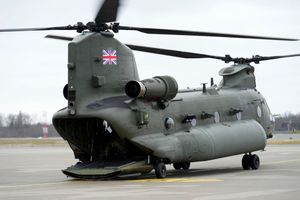 Military aircraft to be equipped to fight wildfires, government says